Investment plot
GI 2.00 HA KONIN MALINIEC - Local Land-Use Plan 17PS
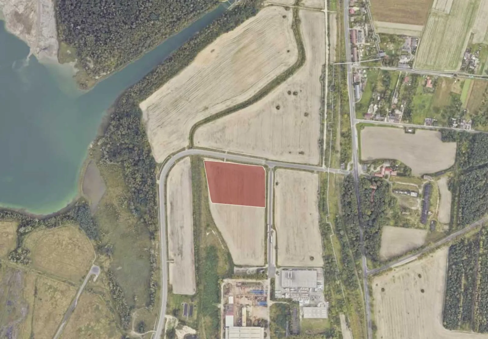 Investment plot
01 / About the plot
Investment plot for sale – Konin
We are offering for sale an investment property with an area of 2.00 ha, located in the industrial part of the city of Konin—in the Maliniec district.
Location: The investment
property is located in Konin (Maliniec district) on Brunatna Street—a strategic road connecting the city’s main transportation routes. Brunatna Street serves as a local link between National Route DK25 (Przemysłowa Street) and Kleczewska Street/Provincial Road DW264, providing good access to both the city center and major regional roads as well as the A2 highway. The site is located in the Maliniec investment zone—an area with a well-developed industrial, manufacturing, and service sector—and in close proximity to existing manufacturing and logistics companies.
Basic information about the investment land:
Location: Konin – Maliniec district.
Area: 20,000 square meters.
Identifier: 306201_1.0008.
Land class: RIVb. Land
registry: unencumbered.
Access: paved road (Brunatna Street).
Price: 200 PLN/sq m.
Designation in the zoning plan – Resolution No. 118 of the Konin City Council dated May 26, 1999, regarding an amendment to the local general zoning plan for the city of Konin within the boundaries of the former Huta Aluminium protection zone.
Primary function of Zone F 17 P/S:
- industrial and warehousing, electricity generation, and broadly defined economic revitalization and services.
PLANNING INFORMATION – DEVELOPMENT INDICATORS
The current local land-use plan does not specify any development indicators (such as maximum development density, maximum building height, or percentage of land covered by development).
A possible point of reference when analyzing the site’s development capacity may be: General Plan – RESOLUTION NO. 438 OF THE KONIN CITY COUNCIL dated August 18, 2026 on the adoption of the general plan for the city of Konin.
68SP Symbol SP Name economic zone. Basic
profile—production area, transportation area, landscaped green space, allotment garden area, technical infrastructure area. Additional
profile—service area
Indicators for the industrial area (according to the general plan):
Manufacturing and services:
- maximum building height: 50 m,
- maximum building density: 3,
- maximum building coverage: 75%,
- minimum biologically active area: 10%.
The General Plan is not a local law, but it can be helpful in analyzing investment potential.
Utility Availability (Infrastructure)
All utilities are available within the right-of-way of Brunatna Street:
✔ water,
✔ sewer,
✔ electricity,
✔ gas,
✔ telecommunications.
Note: The availability and conditions for connecting to utilities must be confirmed and agreed upon with the relevant network operators on a case-by-case basis.
Access and road infrastructure
Direct access from Brunatna Street—a local road connecting to the city’s main thoroughfares. Proximity to National Road DK25, as well as a short distance to the A2 highway—a key logistical advantage for warehouses and distribution centers. Possibility of arranging several entry/exit points (depending on the requirements of the local zoning plan and technical conditions).
Surroundings:
Proximity to existing manufacturing, warehouse, and service facilities. Proximity to urban and industrial infrastructure—support for potential technological processes on the investor’s side. Good transportation links to the center of Konin and other development zones.
Summary – Key Advantages
✔ Strategic location – access to National Road 25 (DK25), the A2 highway, and other regional roads.
✔ Utilities access—connections available for electricity, water, gas, and sewer service.
✔ City of Konin’s investment plans—development of economic and industrial revitalization zones in the Maliniec area.
✔ Development potential – attractive for logistics, service, warehousing, and manufacturing projects.
✔ Flexibility in access point configuration – tailored to the investor’s needs.
✔ Excellent transportation connectivity – both local and regional.
02 / Plot location
Location: Konin
Check the travel-time area (isochrone) and the driving route to any place.
Loading data... Open in Google Maps (new window)
An isochrone is marked on the map, showing the range / commute time at a certain time. You can change your commute time and choose a different means of transportation to see new ranges. To check the range and route of your commute, use the search engine below.
03 / Zoning and utilities
Plot parameters
- Total area
- 20 000 m²
- Destiny
- industrial, Services
- Local zoning plan
- Yes
- Zoning conditions
- No
04 / Polish Investment Zone
Tax relief calculator – Polish Investment Zone
CIT / PIT exemption for a new investment at this location (municipality Konin, county m. Konin, wielkopolskie) – under the regional aid map 2022–2027 and the support decision criteria.
- Max. aid – large company
- 25%
- Medium company
- 35%
- Small and micro company
- 45%
- Min. investment – large company
- 10 m PLN
- Support decision period
- 12 years
- County unemployment rate
- 6.1% (Poland 5.1%)
Nominal estimate (not discounted), not a decision. Aid is calculated on the investment costs or on the 2-year labour costs – the higher amount applies. Unemployment rates: Statistics Poland notice (as at 30.06.2025). A 15-year decision if at least 51% of the site lies in a special economic zone. Ask the advisor about the zone relief
05 / Market surroundings
Location statistics
Labour market, demographics and economy around Konin – municipality, county and voivodeship compared with Poland (Statistics Poland).
06 / Ask about the offer
Find the right space for your business.
We will reply and present the available options.
 Call the advisor
Małgorzata Grabowska
Contact form
Send an enquiry
Fill in the form – an advisor will contact you with the terms.