Investment plot
LAND IN ZAŁUSKI, SZCZYTNIKI NEAR THE S7 HIGHWAY, 3.57 HA, FOR SALE
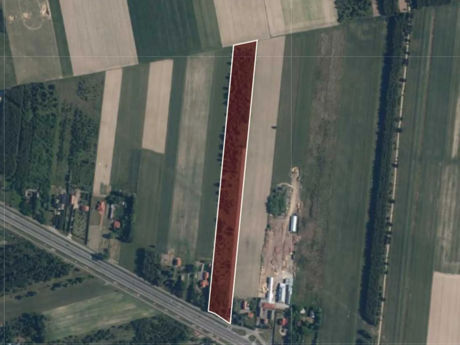 Investment plot
01 / About the plot
Investment plot for sale – Szczytniki
Investment land for sale located in the village of Szczytniki, in the municipality of Załuski, along the DK7 highway.
The property has enormous investment potential, with its primary designated use being residential development and non-intrusive services. Additionally, the lot allows for the development of transportation services, storage facilities, and warehouses, making it an attractive option for investors seeking land to develop residential, commercial, or industrial projects.
The J. Wieczorek Elementary School in Szczytno is located 2.4 km away.
Its convenient location along the main DK7 highway ensures easy access and enhances the property’s appeal for future investments.
Key details about the investment land:
- Location: Mazovia Province, Płońsk County, Załuski Municipality, Szczytniki,
- Parcel ID (Teryt): 142012_2.0022,
- Soil classes: RV, RVI,
- Utilities: electricity, gas, and water on the lot,
- Land and Mortgage Register (KW): exists, encumbered,
- Access: national highway,
- Road type: paved, accessible to trucks.
Planning status:
- Local Land-Use Plan (MPZP) Resolution No. 108/XVII/2012 of the Załuski Municipal Council dated April 4, 2012,
- Designation in the plan: “2.U,MN” and “3.U,MN”,
- Primary use: single-family detached residential development and non-intrusive services, however, the construction of new residential buildings is permitted only if both residential and commercial buildings, or residential-commercial buildings, are located on the same building lot or development lot,
- Permitted uses: transportation services, storage facilities, and warehouses,
- Maximum height of single-family residential and commercial buildings, as well as warehouses: 10 m,
- Maximum floor area ratio: up to 0.8,
- Maximum building coverage: 50%,
- Minimum area of newly subdivided building lots: 1,500 square meters.
02 / Plot location
Location: Szczytniki
Check the travel-time area (isochrone) and the driving route to any place.
Loading data... Open in Google Maps (new window)
An isochrone is marked on the map, showing the range / commute time at a certain time. You can change your commute time and choose a different means of transportation to see new ranges. To check the range and route of your commute, use the search engine below.
03 / Zoning and utilities
Plot parameters
- Total area
- 35 742 m²
- Destiny
- Single-family housing (house), industrial, Services
- Max height
- 10 m
- Development area (%)
- 50 %
- Green area (%)
- 50 %
- Local zoning plan
- Yes
- Zoning conditions
- No
04 / Polish Investment Zone
Tax relief calculator – Warmia-Mazury SEZ
CIT / PIT exemption for a new investment at this location (municipality Załuski, county płoński, mazowieckie) – under the regional aid map 2022–2027 and the support decision criteria.
- Max. aid – large company
- 40%
- Medium company
- 50%
- Small and micro company
- 60%
- Min. investment – large company
- 20 m PLN
- Support decision period
- 14 years
- County unemployment rate
- 9.7% (Poland 5.1%)
Nominal estimate (not discounted), not a decision. Aid is calculated on the investment costs or on the 2-year labour costs – the higher amount applies. Unemployment rates: Statistics Poland notice (as at 30.06.2025). A 15-year decision if at least 51% of the site lies in a special economic zone. Ask the advisor about the zone relief
05 / Market surroundings
Location statistics
Labour market, demographics and economy around Szczytniki – municipality, county and voivodeship compared with Poland (Statistics Poland).
06 / Ask about the offer
Find the right space for your business.
We will reply and present the available options.
 Call the advisor
Michał Narkiewicz
Contact form
Send an enquiry
Fill in the form – an advisor will contact you with the terms.